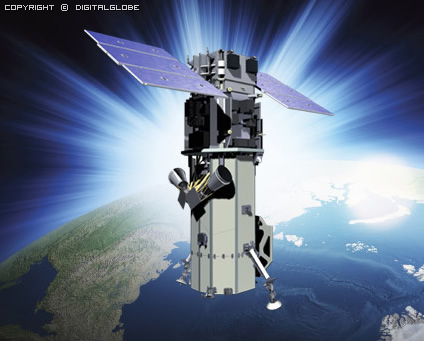
WorldView-3 is a commercial Earth observation satellite owned by DigitalGlobe. It was launched on August 13, 2014, to become DigitalGlobe′s sixth satellite in orbit offers 0.31 meter resolution panchromatic and eight-band multi-spectral imagery. WorldView-3 was recently licensed by the National Oceanic and Atmospheric Administration (NOAA) to collect eight-band short-wave infrared (SWIR) imagery. 12 CAVIS Bands: (desert clouds, aerosol-1, aerosol-2, aerosol-3, green, water-1, water- 2, water-3, NDVI-SWIR, cirrus, snow)
New and enhanced applications include:
- Land Classifications
- Disaster Preparedness/ Response
- Feature Extraction/Change Detection
- Soil/Vegetative Analysis
- Oil & Gas
- Mining
- Environmental Monitoring
- Bathymetry/Coastal Applications
For more information:http://www.digitalglobe.com/about-us/content-collection
| Launch Date | 13 August 2014 |
| Orbit | Altitude: 617 km Type: SunSync, 1:30 pm descending Node Period: 97 min. |
| Life | Spec Mission Life; 7.25 years Estimated Service Life: 10 to 12 years |
| Spacecraft Size, Mass and Power | Size: 5.7 m (18.7 feet) tall x 2.5 m (8 feet) across, 7.1 m (23 feet) across the deployed solar arrays Mass: 2800 kilograms (6200 pounds) Power: 3.1 kW solar array, 100 Ahr battery |
| Sensor Bands | Panchromatic: 450-800 nm 8 Multispectral: (red, red edge, coastal, blue, green, yellow, near-IR1 and near-IR2) 400 nm - 1040 nm 8 SWIR: 1195 nm - 2365 nm 12 CAVIS Bands: (desert clouds, aerosol-1, aerosol-2, aerosol- 3, green, water-1, water- 2, water-3, NDVI-SWIR, cirrus, snow) 405 nm - 2245 nm |
| Sensor Resolution ( or GSD, Ground Sample Distance; off-nadir is geometric mean) | Panchromatic Nadir: 0.31 m GSD at Nadir 0.34 m at 20° Off-Nadir Multispectral Nadir: 1.24 m at Nadir, 1.38 m at 20° Off-Nadir (note that imagery must be resampled to 0.5 m for non-US Government customers) SWIR Nadir: 3.70 m at Nadir, 4.10 m at 20° Off-Nadir CAVIS Nadir: 30.00 m |
| Dynamic Range | 11-bits per pixel Pan and MS; 14-bits per pixel SWIR |
| Swath Width | At nadir: 13.1 km |
| Retargeting Agility | Time to slew 200 km: 12 seconds |
| Onboard Storage | 2199 Gb solid state with EDAC |
| Max Contiguous Area Collected in a Single Pass (30° off-nadir angle) | Mono: 66.5 km x 112 km (5 strip) Stereo: 26.6 km x 112 km (2 çift) |
| Revisit Time(40°N Lat.) | 1 m GSD: <1.0 gün 4.5 gün 20° off-nadir veya az |
| Location Accuracy(CE90) | Beklenen Performans <3.5 m CE90 yer kontrol noktası olmaksızın |
| Capacity | 680,000 km2 günlük |