The Kanopus-V and Belorussian spacecraft BelKA-2 two meter resolution satellites were launched on 22 July 2012 using the Baikonur launch site and a Rokot booster.
The satellites will acquire high-quality panchromatic and multispectral imagery at spatial resolutions of 2.7 meters and 12-meters,respectively, and collect thousands of square kilometers of map-accurate imagery in single day. The constellation will separate on 180°.
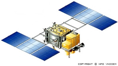
The satellite utilizes the most advanced technologies. The spacecrafts weighs about 500kg and boasts a good resolution capacity, maneuverability, dynamics and other characteristics. Its sun-synchronous orbit allows it to pass over a given area at local time everyday.
Kanopus-V’s advanced geopositional technology is allowing for significant improvements in accuracy as well. The entire satellite turns and swiwels very quickly in orbit to point camera at area directly below, as well as from side to side and front to back. This agility enables it to collect more imagery during a single pass.
For more information:
| Spatial resolution | 2.7m Pan 12m MS |
| Swath Width | 23km (Pan) 20km(MS) |
| Spectral Bands | Pan:540-860nm Blue:460-510nm Green:510-600nm Red: 630-690nm Near Infrared: 750-840nm |
| Viewing Angle | ±40 |
| Revisit Time | 2-3 days |
| Dynamic Range | 8-12bits |
| Memory capasity | 24Gb |
| Mission Life | 7 years |
| Altitude | 510km. |
• Mapping
• Land tenure
• High-operative observation
• Detecting of large pollution emissions
• Monitoring of emergency situtations
• Monitoring of agriculture, water resources