Leica LiDAR Survey Studio (Leica LSS) is a state-of-the-art software tool for point cloud generation and cleaning of raw LiDAR data acquired by the Leica HawkEye 4X and Leica Chiroptera 4X systems.
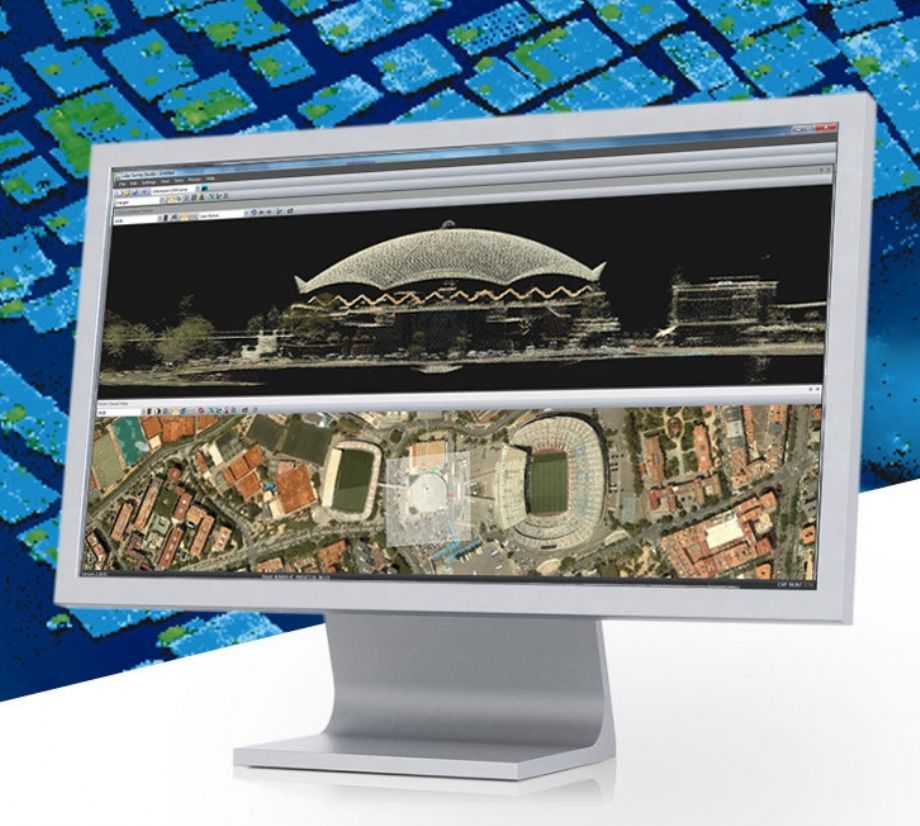
Leica LiDAR Survey Studio provides an extensive software toolbox for processing of multiple missions and simultaneous review of data from all sensor channels. This means that you can review the deep bathymetry, the shallow and the topographic LiDAR data at the same time including reviewing the image taken at the same location as the point cloud data.
In brief, post-processing of raw survey data from the Leica HawkEye 4X and Leica Chiroptera 4X systems consists of extraction of LiDAR points from the waveform data, refinement of position data with use of navigation post processing software and data from reference stations.
In addition, the Leica LiDAR Survey Studio software provides an extensive toolbox allowing:
- Analysis of bathymetric and topographic elevation data
- Multiple sensor windows for simultaneous review of point cloud data and imagery
- Waveform visualisation
- Full waveform review of point cloud data
- Automatic sea surface detection
- Automatic calibration of point cloud and navigational data
- Automatic classification of LIDAR data
- Data quality checks
- Estimates of water and sea floor parameters
- Decision support to the data cleaning process
- Various tools for point cloud data cleaning and export processes
For further refinement of point cloud data and generation of various end-user products, Leica LiDAR Survey Studio provides export functions and is compatible with third party commercial data processing software.